Day 38: Don’t Look Down
November 17, 2019
Kilometers: 927.4-964.6
Pureora Cabins to Piropiro Campsite
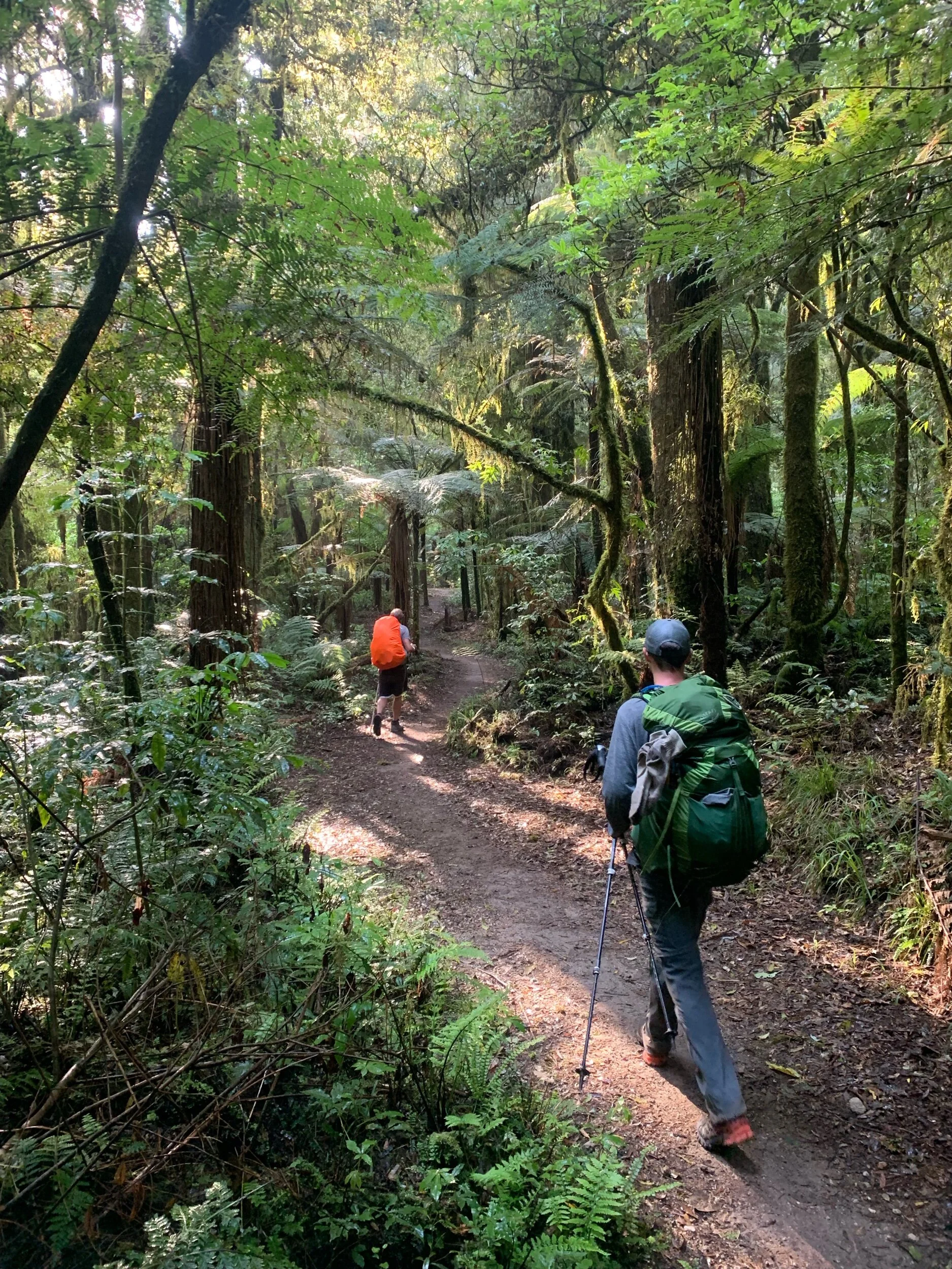
The sky looked exactly the same when we woke up as when we had shut the door of our cabin the day before, cloudy and gloomy with no sunlight shining through. We knew it wasn’t going to rain much if at all though and we’re pretty quick to the trail. Before 8am Ethan, Matt and I were on the Timber Trail with Charlie and Peter not far behind us. The trail notes suggest walking the track in 5 days but we plan on making it in 3, which means some long days.
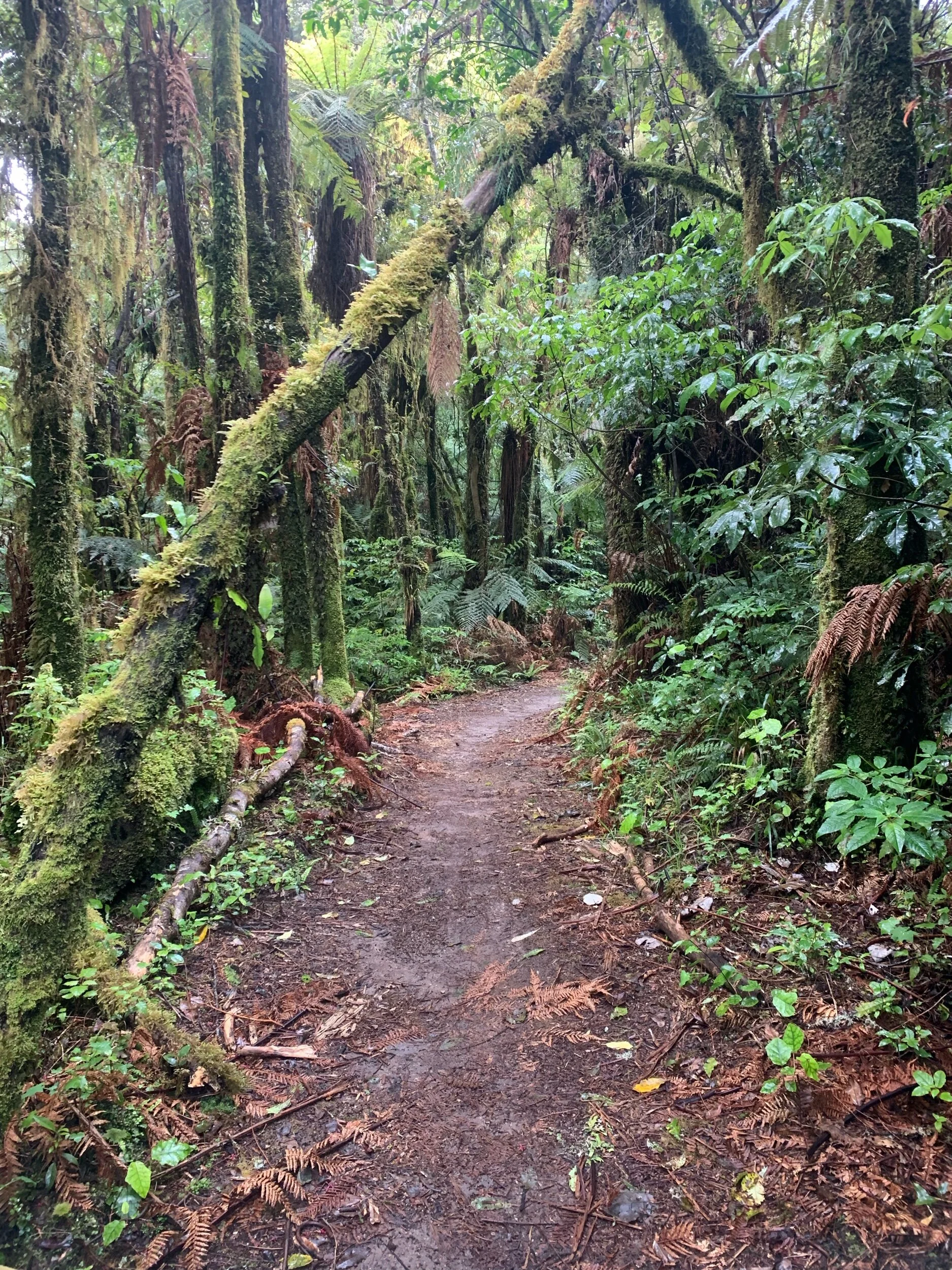
The trail is designed as a mountain bike trail. It is wide enough for the Department of Conservation to drive a four wheeler up and down it to do trail maintenance. They have also gone to many measures to make sure the trail drains well. All of these factors make for a great hiking trail. The first 15 or so kms we’re through dense forest. We so gradually climbed over 500 meters that it was hardly noticeable.
The climb took us to about 1,000 meters above sea level, the highest we’ve been on the whole trail so far. At the top we had the option of doing a side trip up Mt Puerora. Even though it wasn’t raining the cloud cover was going to prevent the good view up there so we decided to forego the detour. Instead we stopped for a bit to have first lunch. After that we walked along the ridge for about 4 kilometers. We hadn’t had cell service in a few days so we’re happy to finally see this sign.
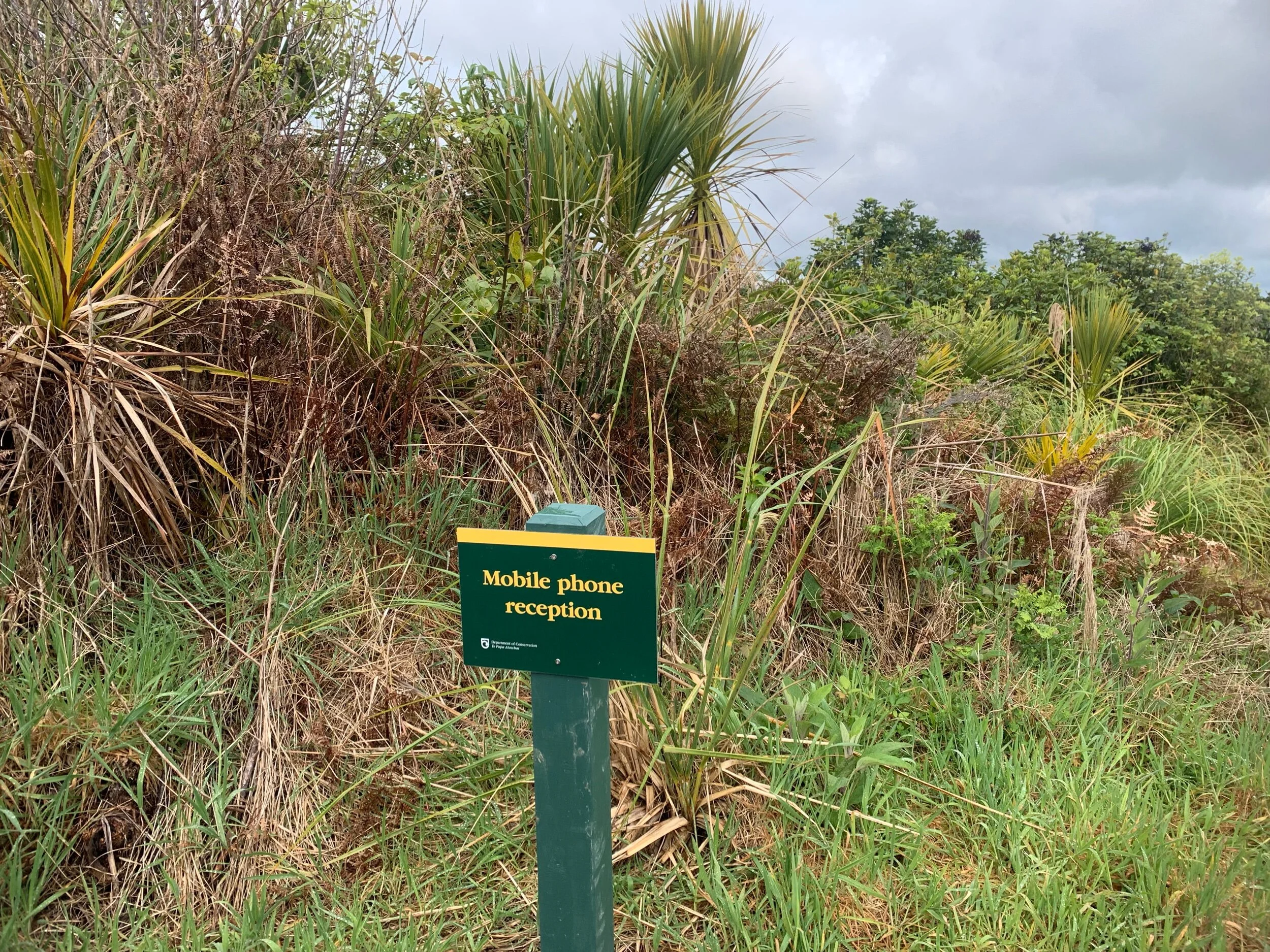
However, Spark and Vodafone, New Zealand’s two largest phone providers, both didn’t get reception there. We cursed the sign for a second before moving on. Eventually on the way down at the fourth sign like this that we saw we got reception. I was able to to reassure friends I had neglected to tell I wouldn’t have service for awhile that I was still alive.
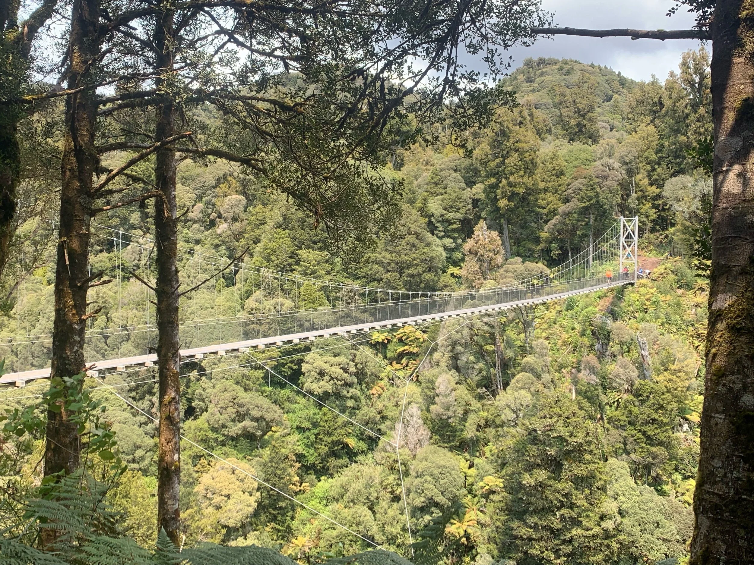
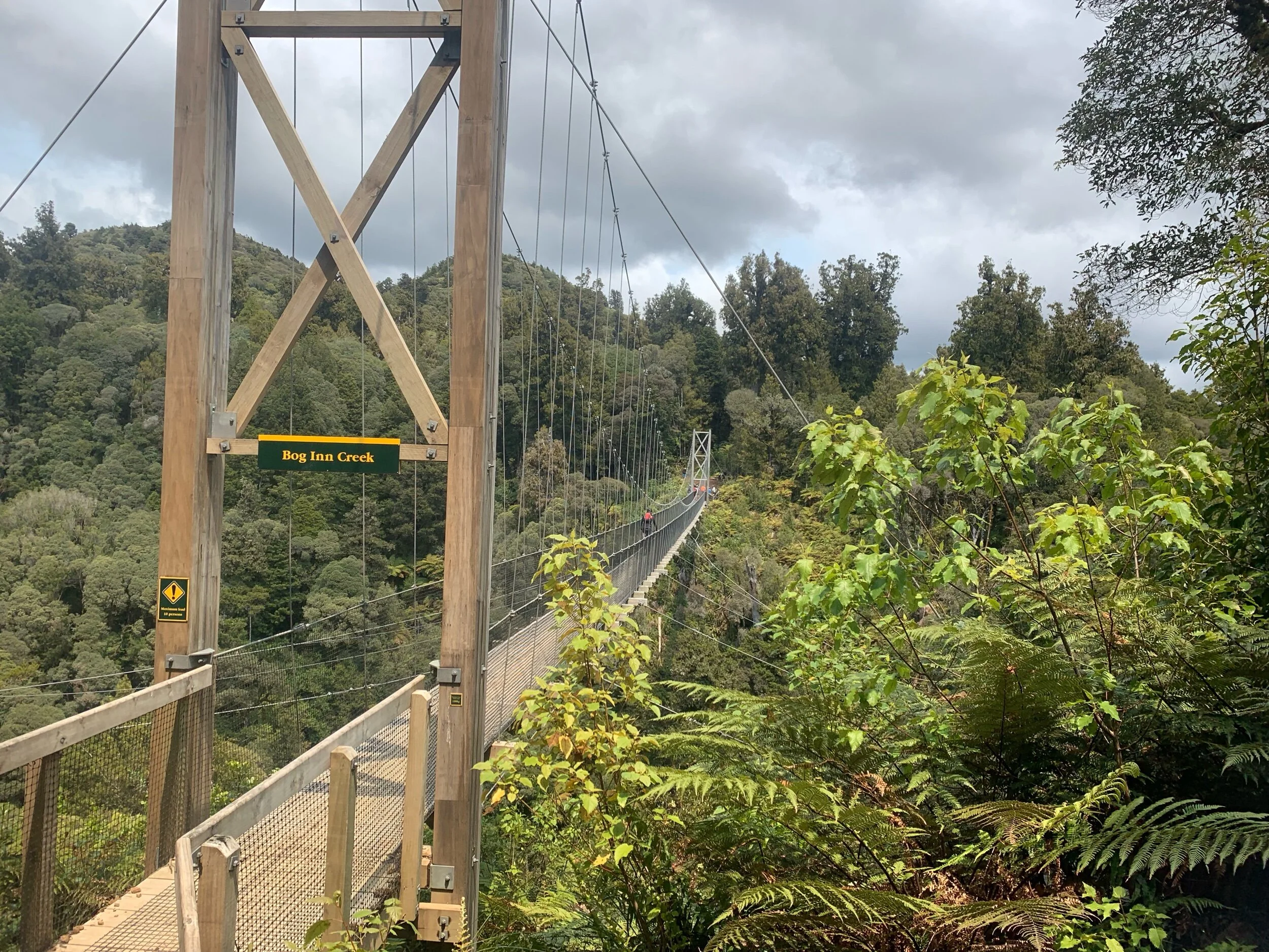
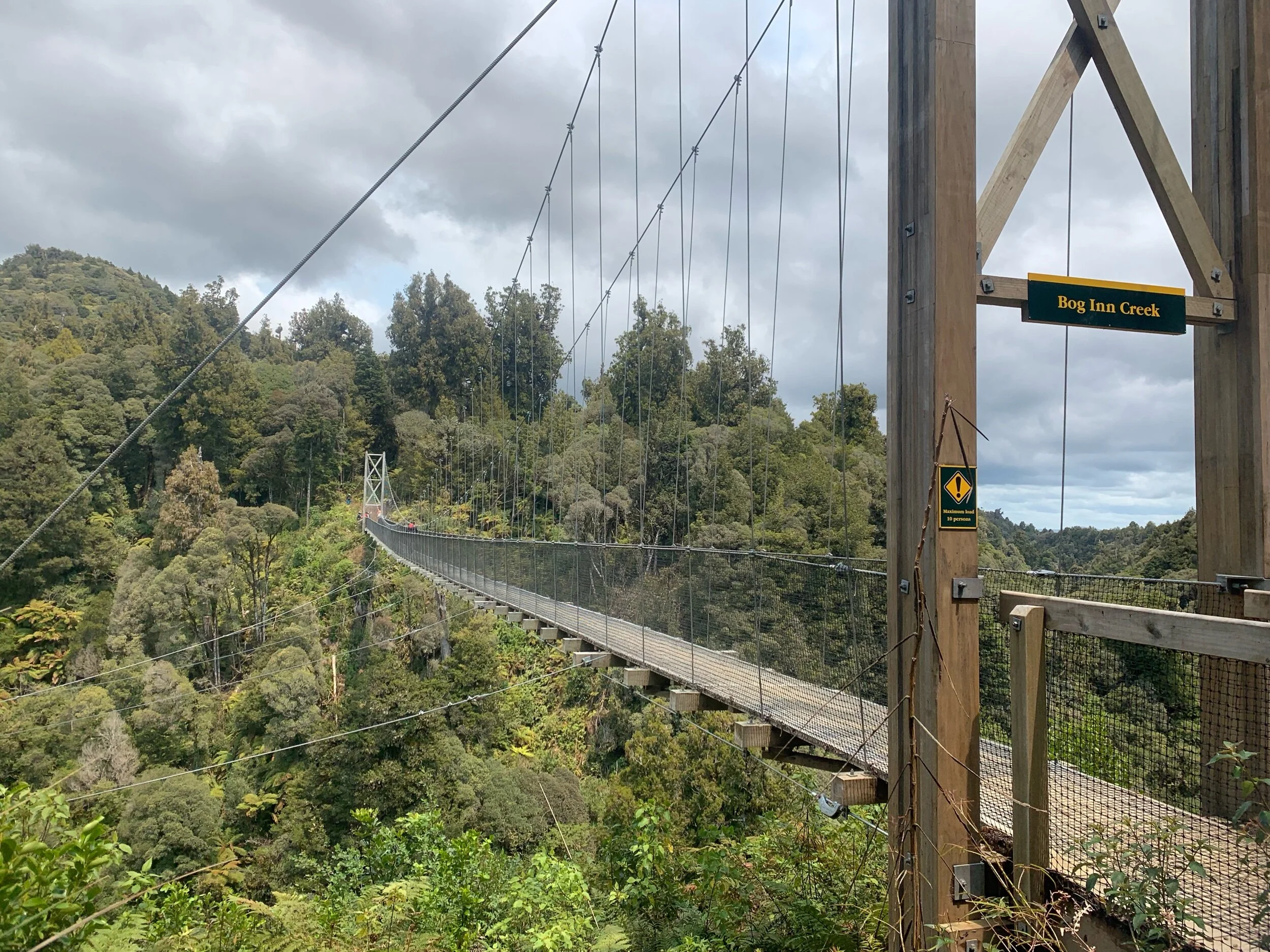
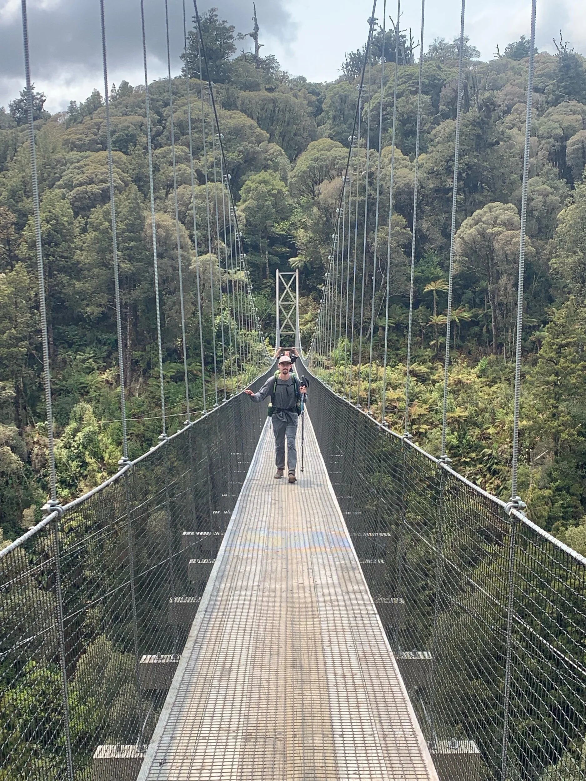
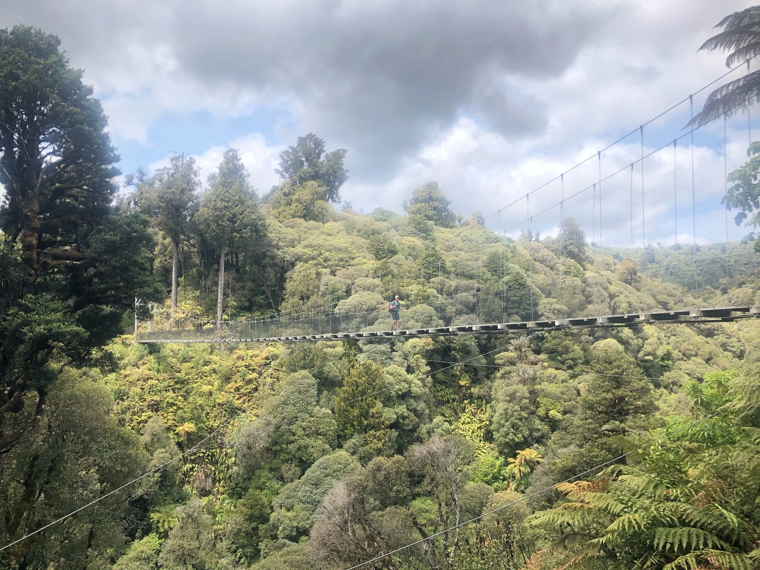
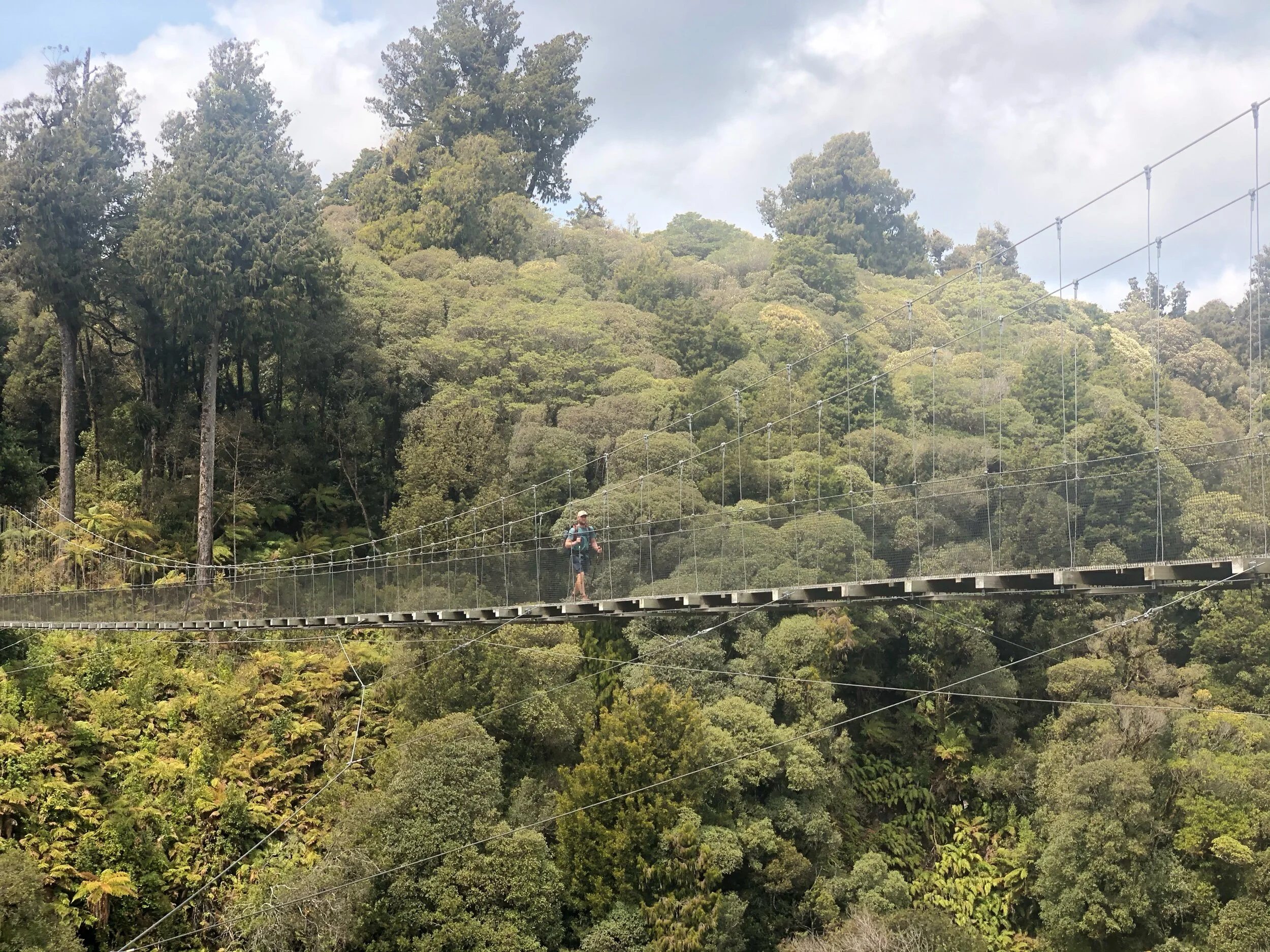
Right before second lunch we arrived at the first of eight major suspension bridges on the Timber Trail. These long bridges gap major valleys and are hundreds of feet high. All of us enjoyed the bridges despite the bounce they had when walking on them.
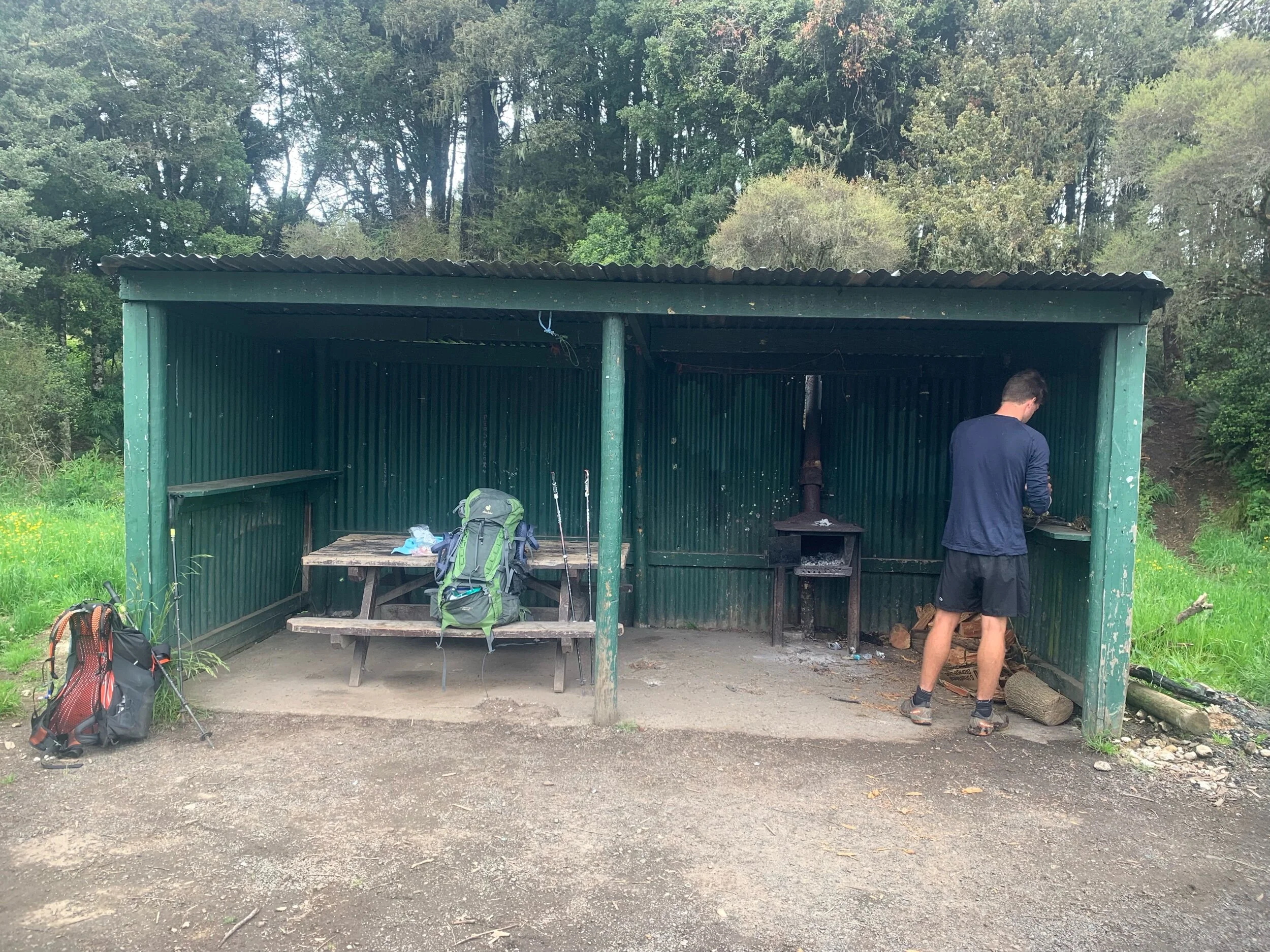
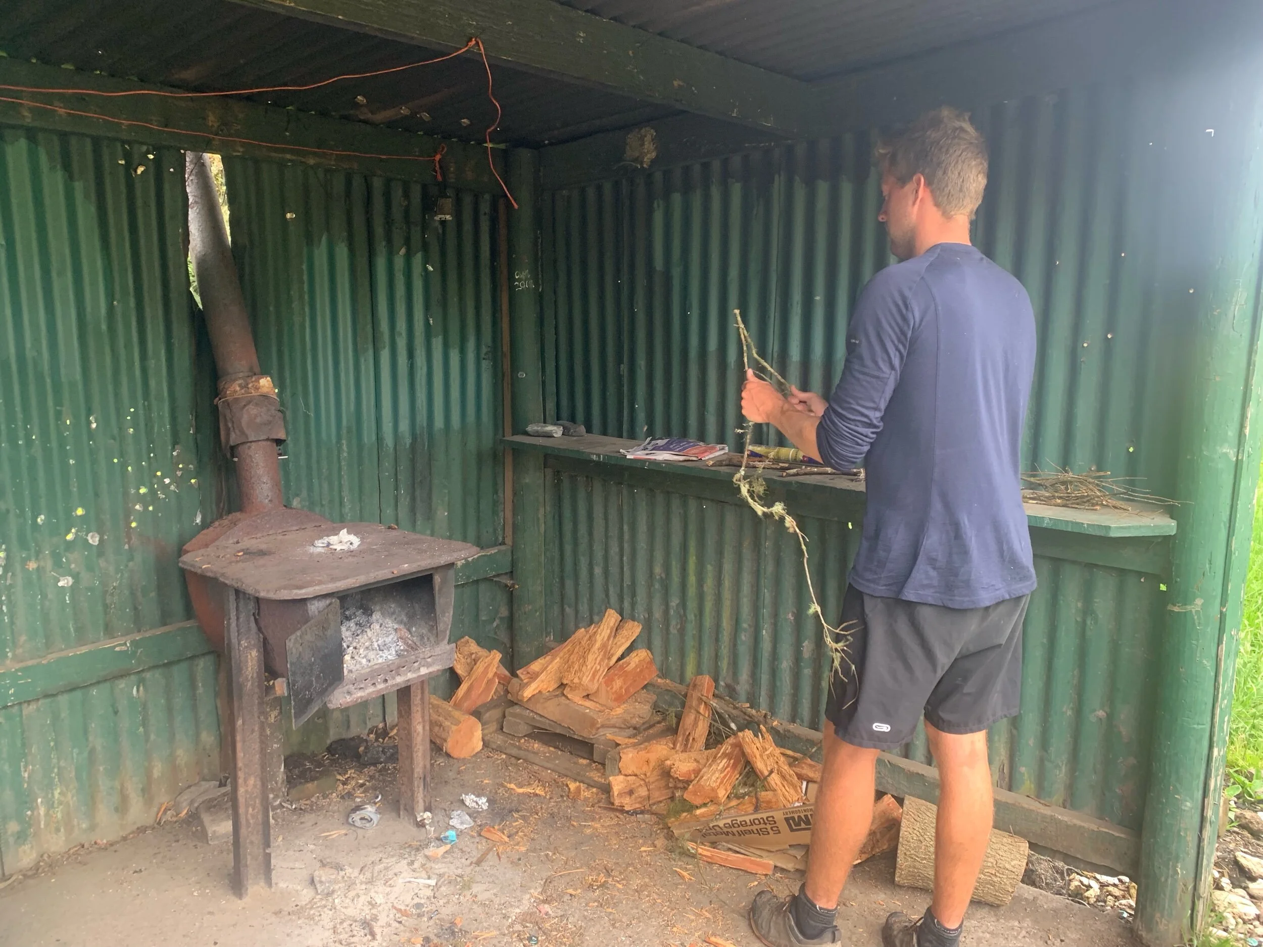
From second lunch we had another 16kms to walk. Everyone plugged in their headphones and took it at their own pace. The trail was not as nice as the morning, intersected by gravel road stretches, but was at least downhill. Everyone arrived at camp between 4:15 and 4:45. We claimed one of the shelters at the large spread out campsite. The shelter had a wood burning stove and fire wood. Peter, who is the group pyro, quickly got to work on a fire.
After we set up camp we decided to head up to the lodge that was a kilometer away for some beer and pizza. Matt introduced us to another solo hiker that he had hiked with before, Henry, a 27 year old kiwi. The six of us slowly made our way up to the lodge as the 37 kilometers we had already walked had taken it out of us.
With a forecast of nonstop rain tomorrow we decided to enjoy the night. We had a few too many drinks but were still headed back to our campsite by 8pm. Ethan and I were still hungry after our pizzas at the lodge so we warmed up chorizo sticks and used pitas as hot dog rolls. As the rain started to fall we all headed to our tents.
One thing we’ve noticed is that we are basically constantly hungry at this point in the hike. As I mentioned earlier we have multiple lunches a day and usually have two dinners. We could eat nonstop if we were able to carry that much food. Last night I saw Ethan consume more food in one sitting than I have in all of my 17 years knowing him. After our huge dinner of rice risotto and ham with a pita he dug into the lunch/snack bag for cookies, craisins, spoonfuls of Nutella and some nuts. Hopefully we don’t get hungrier than we currently are because our food bags are already bursting at the the seams.
-Alex